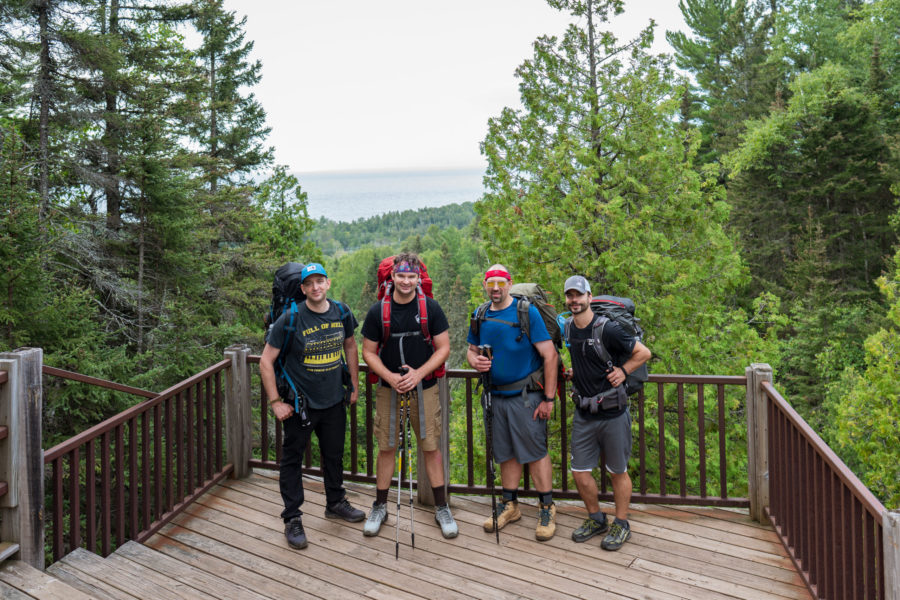
After taking a two year hiatus from backpacking (last year our group did a multi-day canoe/kayak trip instead) we decided to head back into the woods and do a 4 day/3 night backpacking trip on the Superior Hiking Trail. Our previous locations were Isle Royale and the Porcupine Mountains, both, of course, in upper Michigan. I was excited to get the chance to host the guys for a fun filled trip on a pretty famous trail in my home state of Minnesota. I’ll go through some details on the sections we hiked, a few updates on my gear and food, and some brief notes about the sites we picked.
Table of Contents
Gear & Food
I don’t want to spend too much time on this topic as I’ve had extensive posts on both in the last (Food Post and Gear Post). I mainly just want to highlight some of the changes I made that seemed to be improvements from previous trips. For gear, I made primarily two changes, the first being my tent. I’m now using Tarptent’s Aeon Li, which is a considerably lighter and more durable tent as compared to my previous (also considerably more expensive). Fortunately I haven’t really had to use this tent in any meaningful rainfall so I’m hesitant to give it full praise, but so far it’s been really great, easy to setup and pack away, very light and a small footprint in my backpack. It does require a trekking pole (or I suppose a stick if you’re really hardcore) but I typically take those along anyway. The second upgrade (well, two things) was the Therm-a-Rest NeoAir XTherm sleeping pad and the Big Agnes Anvil Horn (650 DownTek) Sleeping Bag. The sleeping bag is a 15 degree bag, which was almost too warm at times, but really came in handy when it dropped down to the mid 40’s. I like how the Big Agnes has a pocket that holds both the sleeping pad and sleeping pillow in place, great for when I shift around at night. Lastly for gear, I reduced the amount of clothing I took. Wearing the same clothing for multiple days turned out just fine, and helping further was my normal method of having a change of clothing I sleep in at night. This change reduced the space in my bag for other items I wanted to take.
The biggest change I made with regard to food was bringing store bought dehydrated meals. I did this only for dinner, but I will say they are really easy, pack a ton of calories, and make for something enjoyable to look forward to in the evenings. Another great combo I love is tuna/salmon packs with Parmesan crisps mixed in. Tea with candied ginger at night was also great.
Arrival
We stayed at an AirBnB in Superior Wisconsin which was a short 10 minute drive from downtown Duluth, MN. I had to take the guys around town so we went to Va Bene where we had an amazing dinner with a great view of Lake Superior.
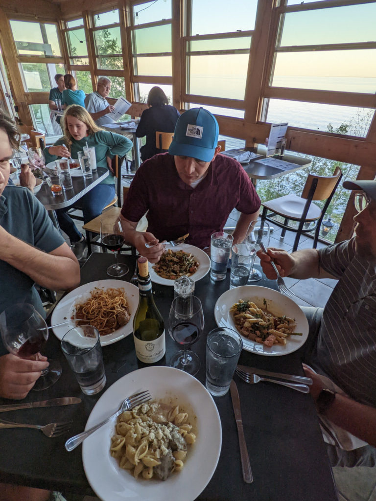
After a great dinner we made our way over to Bent Paddle Brewery which had changed quite a bit since I’d last been there.

It was great catching up and enjoying a perfect evening, but it came to a close and the journey began the next morning.
The Route
As you’ll see in my breakdown later in this post, we chose to hike approximately 25 miles from George Crosby Manitou State Park to Temperance River State Park. After looking along much of the trail in the Superior Hiking Trail Guidebook I liked this route because there were multiple campsite options at nearly the right daily distance for us (6-10 miles). On the SHT the campsite rule is “All come, all serve” so just because someone is already on a site doesn’t mean that’s their site. I wanted a way to move on to another site if our original wasn’t desirable or seemed full, and this route allowed for that (for the most part).
Day One – Bensen Lake Parking Lot –> West Caribou River Camp
This was our most challenging section, and technically the most challenging section of the entire SHT. According to The Superior Hiking Trail Guidebook, “The route through the park is exceptionally challenging; the Trail here is a tangle of roots and rocks with magnificent elevation change…One of the most dramatic ascents of the entire Trail follows, leading steeply to Horseshoe Ridge with views of Lake Superior and Manitou River Valley.” As you can see in the figure below, our route colorized by elevation, we had quite a bit of ups and downs, making it for a tough start.
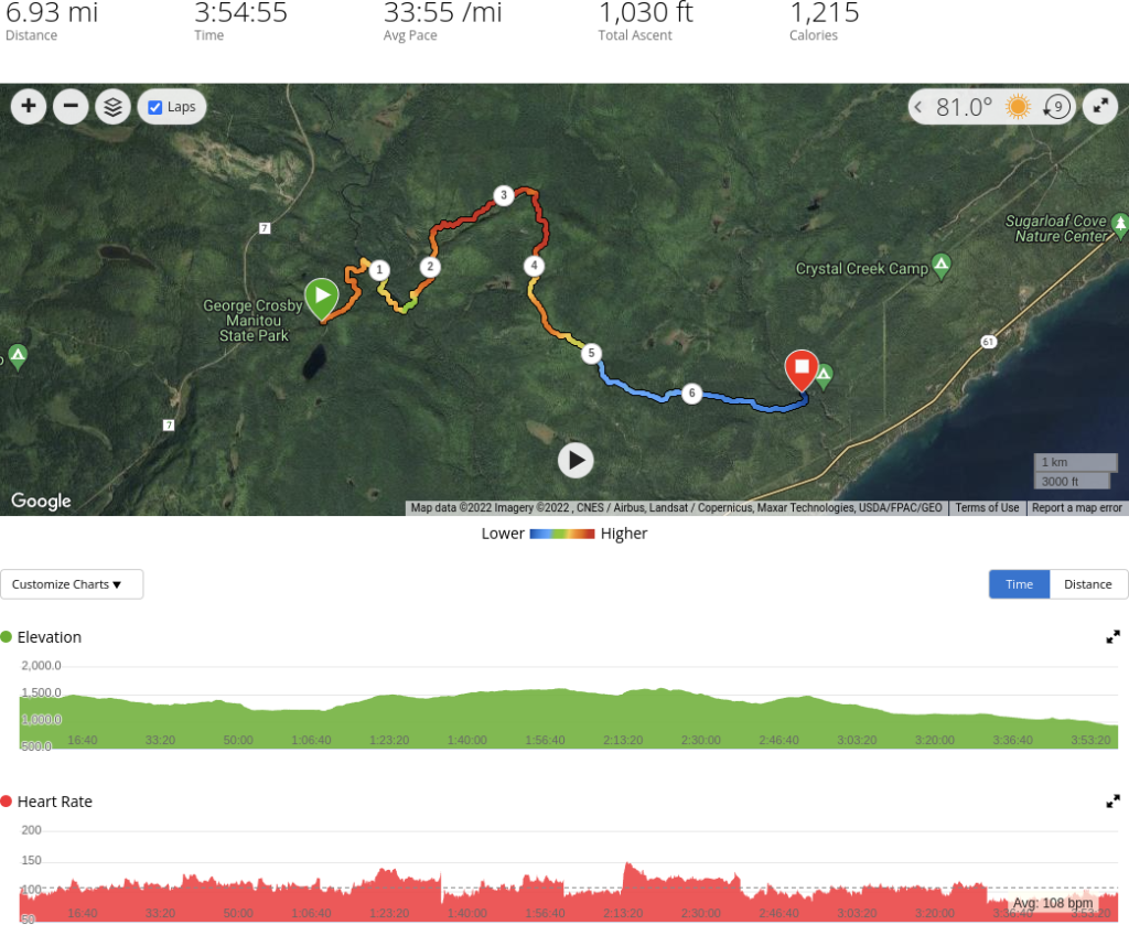
We stopped briefly at the Horseshoe Ridge Campsite but decided to do the additional 2.8 miles down to West Caribou River Campsite, mainly due to the fact that this site had a water source. Because of this change, as I had eluded to earlier, our daily hike plans were altered. We definitely felt our age through this section, but made it and had a great time at the site we stayed at with no other hikers in sight.
Day Two – West Caribou River Camp –> Dyers Creek Camp
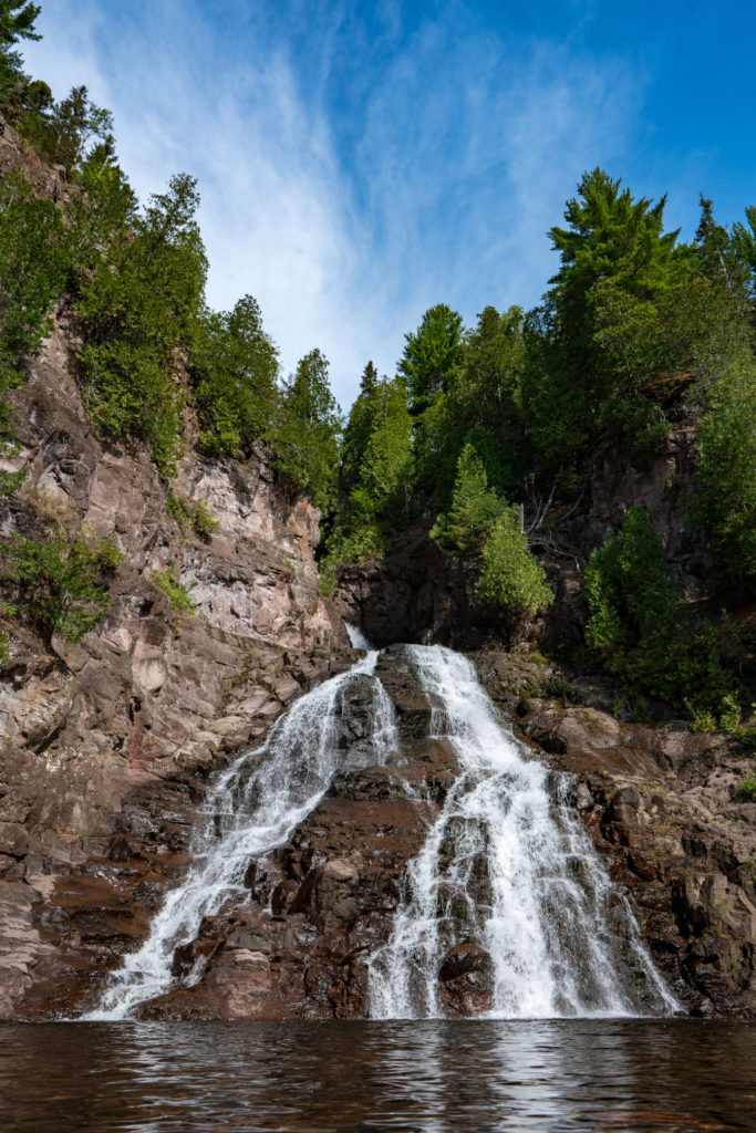
Day two was our longest hike of the entire trip topping out at almost 9 miles, a mile of which was a detour to see a magnificent waterfall, Caribou Falls (image below):
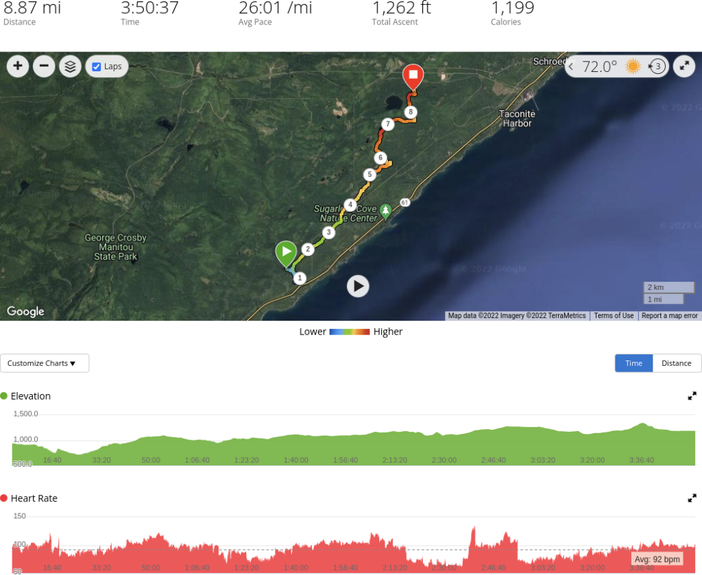
Again you can see based on the coloration of our path that the elevation slowly climbed throughout the day, making for another challenging hike. While at Caribou Falls a fellow hiker warned us that she saw several black bear in the direction we were going so we were also on high alert in case that happened to us (it didn’t).
After a long day we arrived at Dyers Creek Camp only to find a group of 4 backpackers already there. We found a couple spots to squeeze into only to have 2 more backpackers arrive after us. A total of 10 backpackers made for an early night, and the chorus of snoring didn’t help either.
Day Three – Dyers Creek Camp –> The Falls Camp
Back to the trail we went with the knowledge that our day would be much shorter than the previous, and that we would have the ability to pick from 3 different campsites, all within a half mile of one another.
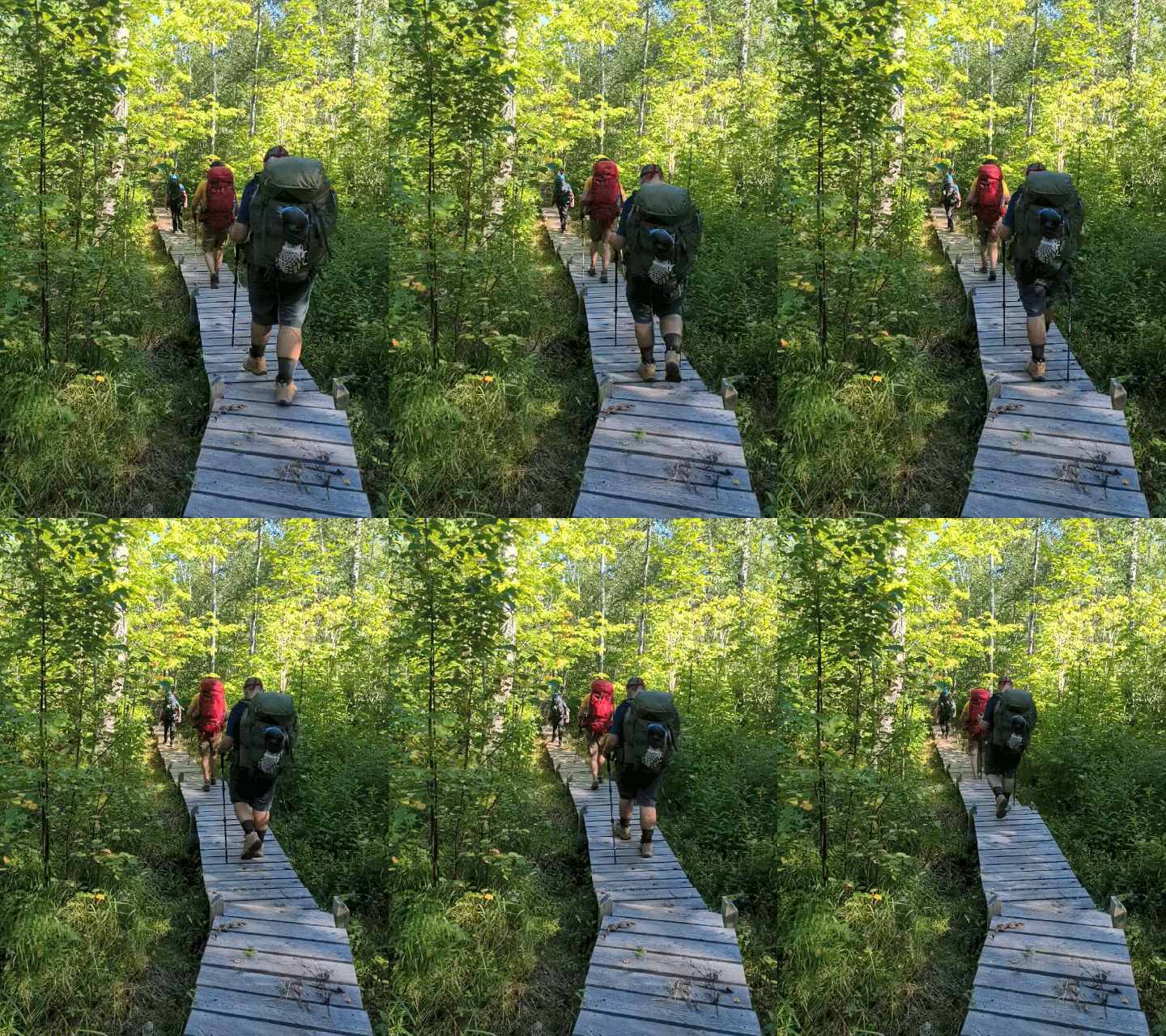
After only 2 hours of hiking, we arrived at The Falls campsite, classified as “small”, it perfectly fit the four of us, with almost no room to spare. It was up on a bluff overlooking a small waterfall which was great access for water and views of the sky.

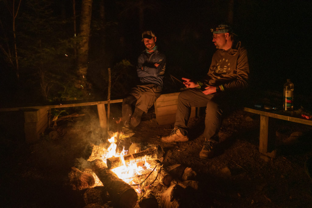
It was here we had the entire afternoon and evening to relax, enjoy some time away from everyone, and even built a big fire (nice work Mike!). This was our last full day on the trail, and we enjoyed it.
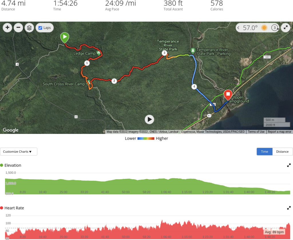
Day Four – The Falls Camp –> Temperance River Falls State Park
Our last day was one of largely downhill travel for what we thought would be 3 miles but ended up being nearly 5. I miscalculated where we parked and had to cut over on a different trail to get down into Temperance River State Park, which wasn’t really a big deal. We finished our trek out in under 2 hours.
Trip Video
I created a YouTube video which summarizes our trip and has some of the drone footage (and photos from Davis Ciotola) I took.
Reflections
There were a couple things I didn’t really care for when it came to the Superior Hiking Trail, the biggest being the lack of ability to reserve a campsite. I get it, there’s probably too many backpackers to really make that work, and it’s also really difficult to enforce, but it is the one thing I really did like that both the Porcupine Mountains and Isle Royale had that SHT didn’t. I thought the sites themselves were well setup, most if not all had benches and a primitive toilet, and many had a water source, which is essential. The terrain was pretty dynamic (not as dynamic as the Porcupine Mountains) and kept things interesting. Parking was also a bit difficult to figure out at first. Where we are and aren’t able to park, whether we needed a parking pass or not, etc….
I will also say, we’re not getting any younger, so every year it gets a bit harder to make these sorts of trips, but I do thoroughly enjoy them, even the grueling hiking sections. It was also nice finally getting out on the Superior Hiking Trail after living in Minnesota for over 8 years now (about time!). I can’t ask for a better group of guys to backpack with, and am looking forward to our future endeavors, whatever they may be.

